Add files to a project
Who can do this
Owners and administrators, branch managers and members in their branch, and a project's leads and contributors. Viewers, billing managers and auditors can read the files but not add them. Every plan. Your plan sets the largest file you can add and how many uploads a month you have.
Drop files on a project's Files list: GISweaver puts each map file in the draft and keeps everything else with the project.
-
Open Add files and choose the project the files belong to. (If this is new work, create a project first.)
The Projects page reads Choose a project below to add files.
-
On the project's Project tab, drop your files on Drop files here, or browse above Files, or select it to choose files. On a phone, selecting it opens your camera roll and files.


Drop files on the strip, or select it to choose files from your device.
The strip names the formats it takes. A project with no map yet also shows Drop a map file here, or browse in the map, which does the same.
-
Watch each file appear at the top of the list with how much has arrived, then read Checking while its checks run.
Each file has a row of its own, newest first.
-
Leave the page open until every file has arrived. You can open other pages in GISweaver meanwhile; closing the tab pauses a file that is still being sent.
Every row reads Checking or past it, and no row reads Uploading.
What happens next
When a file's checks pass, it takes its place in the list. Which formats are which, and the most one file may be, are on Supported files and limits.
- A map file joins the project's draft, the working copy of the survey that you check before publishing. Once processed, its row reads On the map and In the draft, and the file is drawn on the project's map.
- Every other file is a kept file: kept with the project as it came and scanned for malware. Its row reads Photo, PDF, Video, Archive or Other file, and Internal only.
Adding a file publishes nothing. If you drop a map file on a Published or Completed project and may start a draft, GISweaver asks This project is published. Start a new draft for Release 2 with these files?
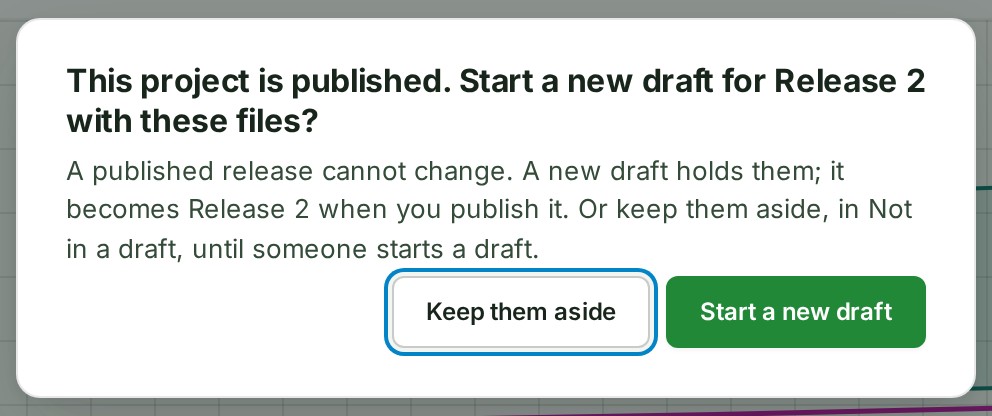
- Choose Start a new draft to open the draft and send the files into it.
- Choose Keep them aside to send them now and leave them under Not in a draft until someone starts a draft.
A colleague who may not start a draft is told why, and the files wait under Not in a draft. Files you drop while the question is open join it, and closing it with Escape keeps them aside, so no file is lost. If the draft cannot be started, the reason is shown and the files stay held until you try again or keep them aside.
If something goes wrong
Some files are refused before anything is sent, and no upload is spent on them. A banner above the list names each one with its reason:
- It is …. Your plan accepts files up to … each (…). The file is larger than your plan allows for one file. Billing readers see See what each plan includes; anyone else reads Ask the owner or a billing manager of your organisation to change the plan. See What your plan allows per file.
- The file is larger than the most one file may be. No plan takes a file over that fixed limit. Split it into smaller files and add those.
- GISweaver does not accept programs, scripts or web pages, because they can run on the computer that opens them. A program, script, disk image, macro-enabled Office file or web page is refused whatever the plan.




- A file can also stop after it was sent. Its row reads Refused or Failed with the reason under its name: see Fix a file that stopped.
- You can read this project. Adding files needs the Contributor role on it appears where the strip would be, and names a project lead to ask. Your role may read the project but not add files.
- Drop files here, or browse is greyed out with Frozen — renew to save new work. The organisation's paid plan has lapsed.
Details
What the strip says
The strip lists the formats it takes, and the file picker lets you choose any file. The Owner, Admins, Billing managers and Auditors also see the plan's limit for one file, for example Files up to [size] each on the [plan] plan. Anyone else is told only after the plan refuses a file in this tab; a larger file chosen after that is still sent, with a note that the plan may refuse it.
What is checked
Select What is checked under the strip to see the six steps every file goes through (Read, Check, Convert, Map tiles, Preview, Add to draft). Every file is checked for its type and that it is whole, and scanned for malware before it reaches another organisation.
If the scan finds a threat in a file, its row in Files reads Flagged by the malware check. You can still open it here, but it is never sent to another organisation. You keep the file; no share, delivery or review hands it to anyone else.


How many files send at once
A chip beside Files says when your organisation is sending as many files as it is allowed. New files then wait in your browser and start by themselves when another finishes, as long as the tab stays open. The limit is the organisation's, not this project's: see Follow an upload.
A file the project already has
A project keeps one copy of a file. If a file you send has exactly the same contents as one the project holds, the new copy is not kept, is not stored and does not count against the month's uploads.
A line above Files names the file that is there, for example site-visit-report (1).pdf is already in this project, as Site visit report.pdf. The new copy was not kept. Select OK to clear it.
GISweaver compares contents, not names: a different file with the same name is kept, and the same file can be added to another project. A file deleted from the project, a map file removed from the draft, or a map file whose processing failed can be sent again and is kept as new. The organisation's audit trail records each repeat.
From the map
On the project's map, Upload sends files to the same place. It names every file it refuses, but leaves the plan's limit for one file to the upload itself.
Other words are in the glossary.
Next: Read the Files list