Measure a distance or an area
Who can do this
Owners, administrators, and colleagues who can add work to the project (branch managers and members, project leads and contributors). A Viewer, Billing manager or Auditor has no measuring tools. Every plan.
Measure along a line you click on the map with Distance, or the ground inside a shape with Area; the measurement is kept with the project as saved work.
- With a project open on the map, select Distance (or press 3) or Area (or press 4) on the tool strip. The status bar says what to click.
- Click the map at each point. The Inspector shows the length or area so far.
-
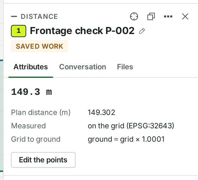
Press Enter, or double-click, to finish. The Inspector shows the finished measurement.
-
To name it, select the pencil beside its name in the Inspector (Add a name when it has none). The name box opens.
- Type the name and select Save. The name stays on the measurement.
What happens next
The measurement stays on the map and is listed under Saved work in the rail, named after its kind and a number, such as Distance 1. The status bar says Saving work… and then Saved work is up to date. Everyone who can open the project sees it.
With the measurement selected, Delete or Backspace removes it without asking.
If something goes wrong
- You placed a point in the wrong place. Press Backspace before you finish, to remove the last point you placed.
- Saved work could not be updated. Nothing is lost — saving will be retried. Your connection dropped. Keep working; GISweaver saves again when it can.
- Someone else changed this project’s saved work. Reload to see their changes. Reload the page before you change that measurement again.
- These points enclose no area. Move a corner off the line (in the status bar). The corners lie on one straight line, the outline is a sliver with no ground inside it, or its edges cross themselves. Nothing is saved: move a corner off the line, or redraw the outline without crossings, and finish again.
- This organisation is frozen, so nothing new can be added. Ask an owner to open Billing and unfreeze the organisation.
For units, the controls and how each figure was measured, see Measuring in the map reference.
The product words on this page are explained in the glossary.
Next: Draw a point, distance or area and keep it as saved work